Sunway University Partners with Japanese Companies and Sarawak Forestry Corporation on Mangrove Forest Management Using Drones
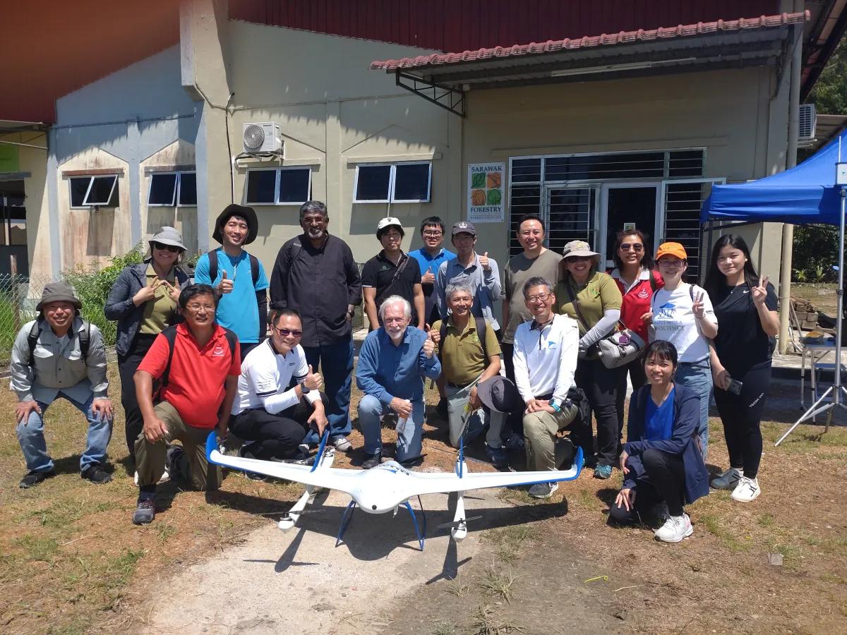
Sunway University, a top private university in Malaysia collaborates with two Japanese tech companies, drone development company Aerosense Inc. and IT solution company funlead corp., and two Malaysian institutions, namely the Sarawak Forestry Corporation (SFC) and the University of Technology Sarawak (UTS), in the mangrove conservation project under the Asia-Pacific Telecommunity (APT)’s ICT Pilot Projects for Rural Areas (Category-II).
This project is a continuation of the previous ICT Pilot Projects for Rural Areas (Category-I) project, which allowed large-scale research on mangrove forests in Sarawak. The current Category-II project extends the previous work to Kuching Wetlands by capturing multispectral and hyperspectral images of the mangrove forest and using them to develop a machine-learning-based application to assist experts in the identification of mangrove trees based on digital imagery. This project encompasses the wetlands in Kuching Wetlands National Park, Sarawak located 15 km from Kuching and roughly 5 km from Damai Beach, covering 6,610 hectares on the estuarine reaches of the Sibu Laut and Salak Rivers.
Professor Sibrandes Poppema, President of Sunway University said, “The University is delighted with this collaboration that brings together Japanese companies, Sarawak Forestry Corporation and Sunway University in a great example of the use of human machine collaboration for the assessment of mangroves along Sarawak river to promote Planetary Health.”
The Human Machine-Collaboration (HUMAC) research team of Sunway University led by Prof. Yap Kian Meng, Head of Sunway University’s Research Centre for Human-Machine Collaboration, serves as the cerebrum to the project and manages the different teams involved. The plan consists of using Vertical-Take-Off-and-Landing (VTOL) Unmanned Aerial Vehicle (UAV) technology and global position system (GPS) technology to capture hyperspectral images of mangroves and nipah to create a high-definition mapping of the specified protected mangrove site.
The resulting data will be used to develop a classification model through machine learning and image processing, which will then assist the SFC in the conservation of the protected mangrove area through digitizing the monitorization of plant health in the area and supporting mangrove tree replantation. Japanese experts from Aerosense Inc. and funlead corp. will provide technical assistance and guidance throughout the duration of the project.
According to Deputy Minister for Urban Planning, Land Administration, and Environment, Datuk Len Talif Salleh, the collection of various types of data through drone surveillance is vital for further research and enhancement of forest protection efforts in Sarawak. Datuk Len stressed the significance of this data in guiding the state government’s forest management strategies without compromising surrounding habitats and the environment. “This is in line with our PCDS 2030, which embodies social responsibility by involving the community for economic prosperity and environmental sustainability. Apart from that, we will also learn how we can manage our resources efficiently. That is how we move forward,” added Datuk Len.
This project, which will promote the sustainability of mangrove ecosystems in Sarawak and bridge the technological gap in rural areas of Sarawak, is a step forward to several Sustainable Development Goals (SDG) launched by the United Nations (UN).
Team members:
Associate Professor Dr. Lee Yunli
Associate Professor Dr. Lin Mei-hua
Ir. Dr. Steven Eu Kok Seng
Dr. Athirah Mohd Ramly
Dr. Yong Yoke Leng
Field Assistants/Student Helpers:
Lim Han Shen
Chew Zhe Zhi
Teoh Jiehan
Yau Lye Hong
Ahmed Omer Ahmed Mohamed Zain
Ooi Ke Vin
Alexander Chieng Yu
Jessica
Misha Camelia binti Raemous Ridzuan
Ng Jia Wen
Kho Zi Jian
Ong Hui Yan Kimberly
Yap Yu Heng
Justin Phang Sheng Xuan
Koh Ji Shin
Chin Yu Wei
Yap Yi Rou
Raveen A/L Therum Thurai
